10-14 June 2004
Skip boring narrative and jump straight to pictures...
Arriving at about 11pm after light rain, we camped next to the carpark at Pincham, and headed down to the Visitor's Centre the next day to register. The walk in along the Pincham Track was quite easy for the first bit, and then became a slog as we started the climb up to the Breadknife. It's mostly paved or with constructed stairs, due to erosion of the previous trail. Doesn't speak much for the wilderness experience, but I guess a rutted track poses its own problems.
We arrived at Balor Hut to find only a very small patch of flat bare ground to erect our two tents. Not ideal, but we just managed to squeeze in without being on too much of a slope. After a quick lunch, we set off to try and climb Vertigo (10) on Belougery Spire.
It was more of a climb to Belougery Spire than we had expected. You almost go all the way up to the top of the Grand High Tops, past the Bread Knife, the Butter Knife and the Fish Knife, before heading along an easy ridge. Once there, it took us quite some time to get to the Halfway Ledge, using rope in a couple of places where the rock was still wet from the rain. It was 2:30pm by this stage, and with three of us climbing on one of the shortest days of the year, we knew we were going to be walking off after dark. We started at a 'V' on the rock, and Andy led the first pitch, stopping only as he ran out of rope, luckily close enough to a ledge.
The sun set over Bluff Mountain as we finished the second pitch, and looked for the descent. The anchor was down the bottom of the adjacent gully and consisted of a solid fixed hanger with a maillon, and a dodgy pair of flat metal plates held into the rock by a couple of bolts which had most of their shafts showing. The anchor had a sling tied in a 'Death Triangle' so I retied it and we rapped off in the dark. Thankfully the rap ended up in a place that I recognised and it was a short scramble to where our bags were.
It took us about another hour to get off the Spire, doing another two abseils down the tricky sections, plus a fair bit of scrambling in the dark. My LED torch started to wane, and I took a wrong turn and just about walked off a cliff. We mostly relied on Andy's Petzl to get out, although I used my mobile phone to provide a bit of light! We stumbled along the Grand High Tops in the dark until we found the markers, and then headed down the long descent back to the campsite, which we reached at about 8:30pm.
The next morning we set off to Crater Bluff, to try and do Tourist Route (9). The walking was much easier to Dagda Gap than the Grand High Tops had been the day before. A track led down the creek opposite to a creek junction below Crater Bluff, and then it was a short climb up to the cliffs. The description said to scramble up a series of ramps from the north end of the west face, so we headed up what looked like the most promising line. After using the rope up a steep bit, it petered out. Gill belayed Andy across the face, but it wasn't clear if the ledges started again. We backed off looking for a higher option, but only found our way to Cornerstone Rib (14). After checking it out for a possible attempt, we headed down to the lower ledges and made our way along a narrow one which also looked like a possibility. It petered out beneath an overhang, which was in the description. However, there was also supposed to be a pillar above which we couldn't see, and it looked a slightly precarious place to start a climb.
In the end we decided to leave the gear in the bush and walk to Bluff Mountain, and try for Cornerstone Rib with an early start the next day. It was a relatively short walk to Bluff Mountain - about half an hour to Dows Camp (which had running water in the creek) and then half an hour to the top. Wedge-tailed Eagles soared overhead, swooping close at times. There were excellent views of the southern part of the park, including Tonduron Spire, and of Crater Bluff some way below. After some time spent wandering around the top and taking in the sights, we headed back down past the numerous grass trees and reached camp late afternoon for an early night.
It was before dawn when we woke, had breakfast, and retraced our route from the previous day to Crater Bluff. We retrieved our gear from where we had left it and climbed up to the corner that Cornerstone Rib runs up. The wind was strong and blustery, and while not freezing cold, it was pretty unpleasant all round. Andy slowly climbed the first pitch, to a ledge with minimal bits of gear. The climbing looked relatively easy to that point, bar the wind. Then followed a conversation between the three of us that was difficult to hold due to the gusty wind. The upshot of it was that it was going to be a very unpleasant climb, and that we would give it a miss. Andy downclimbed the pitch, and we aborted back to Balor Hut to pack up.
To add a bit of variety to the walk out, we decided to return via Ogma Camp and West Spirey Creek. Like East Spirey Creek, the creek bed was basically dry.
It was about lunchtime when we arrived back at Pincham car park, and we drove down to the visitor's centre to sign out. After lunch, we headed to ?? Cliffs, near the main campground. Andy's knee was hurting a bit, but the decision for him of whether or not to climb was made easier by the fact that he had left his climbing shoes back at Crater Bluff! I led Prologue (11), an easy climb although a bit light on gear and solid holds. Gill and I climbed back down off it in the dark.
Camping again near the Pincham car park, Andy dosed up on ibuprofen and walked in before dawn to Crater Bluff to retrieve his shoes. Gill and I were only just having breakfast when he got back, so he made pretty good time.
Then we headed out of the park and down the road to Timor Rock, another of the volcanic protrusions in the area. We ended up doing a lot of scrambling around the base, some of it slightly dodgy on the slick rock, to reach the start of Tourist Route (8). The climbing was quite pleasant, although we really didn't know where we were going. I led the last pitch, but there wasn't much to anchor to up top. After taking in the view we walked all the way to the other side to the abseil point - a rather dead and not particularly solid tree. Not very comforting. I held the tree while the others abseiled, and then rerigged it to put less strain (but a harder pull down). There weren't too many other options, as all of the big trees seemed to be dead on top of Timor Rock.
Anyway, we all reached ground safely, if nervously, and scrambled back down to the car.
Then it was the long drive back to Sydney.
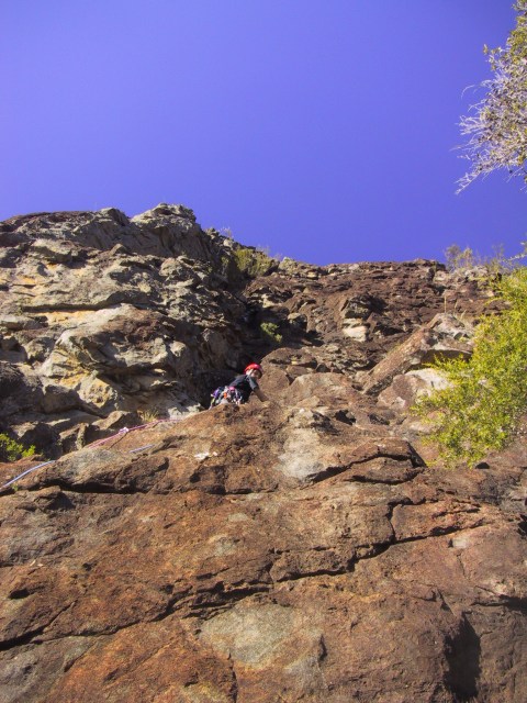
Andy on the first pitch of Vertigo (10), on Belougery Spire
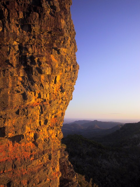
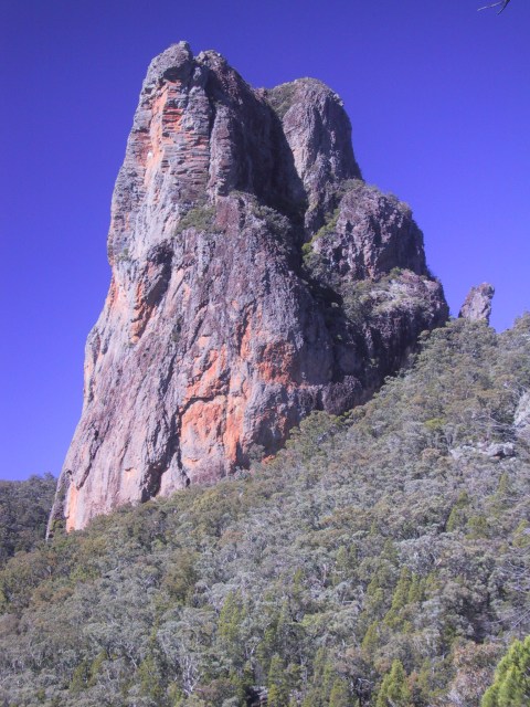
Belougery Spire glows red with the setting sun
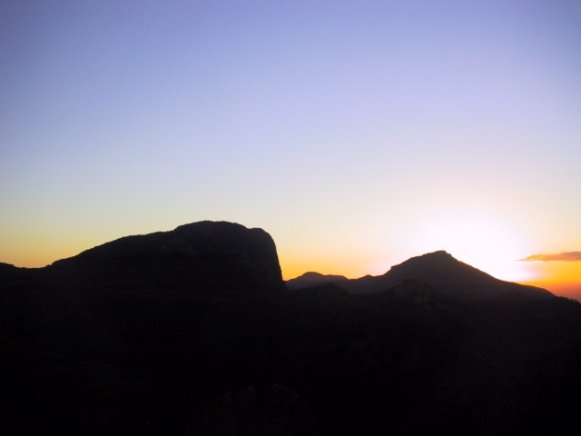
Bluff Mountain and Mt Exmouth silhouetted in the twilight
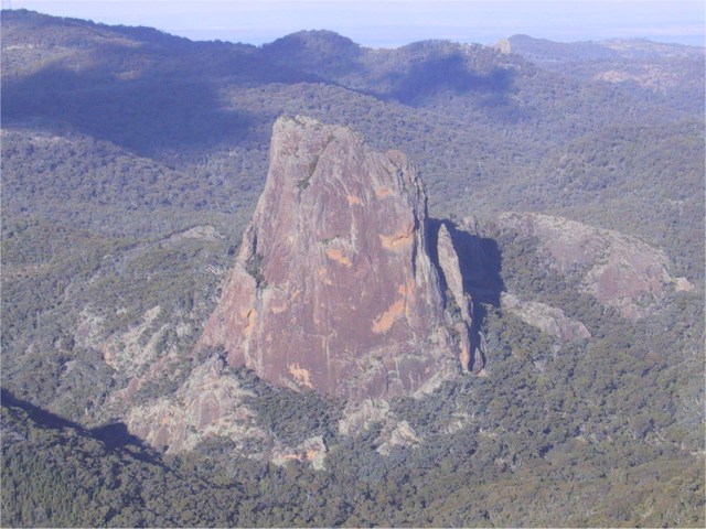
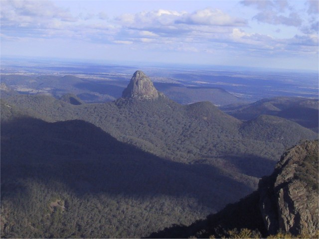
Crater Bluff, from Bluff Mountain
Tonduron, from Bluff Mountain
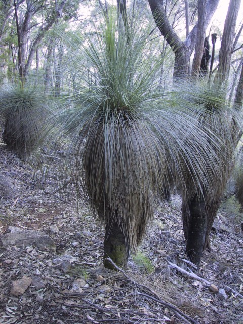
A stand of grass trees, Xanthorrea glauca ssp augustifolia, which are common in parts of the park
The Breadknife
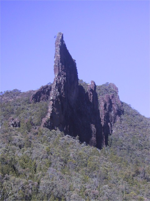
Belougery Spire - Abseil Gully is deep in the shadowed corner, and the Halfway Ledge is in sun just below the large shadow section
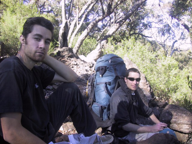
Tom and Andy relaxing on the walk out
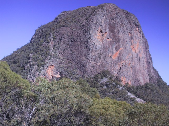
The massive face of Bluff Mountain